Our Services
Scan to point
cloud
All physical objects have data information points. These data points can be measured and used to create a set of data points known as a point cloud. Most often, a point cloud is used to represent a 3D object such as a building or structure.
At its core, a point cloud is an accurate representation of a building or structure at the time of its capture. It can be a great tool for reviewing aspects of the captured property. Likewise, it can serve as a foundation for 3D models based on the property, serving as a formative step for any number of building capturing projects.
What is scan to point cloud?
Through the use of advanced scanning and photogrammetry technology to obtain information, we then map out the data points using the reflection of light and colour variations and, from there, establish X, Y, and Z coordinates. These techniques form a core part of what it takes to create a point cloud.
Advances in this technology have increased both the speed and accuracy of point cloud surveys. This makes the construction of a point cloud more viable for the client’s business than ever before. We are able to create more accurate 3D models at greater speed. From survey drones to Faro scanners, the advances in technology allow for the creation of faster and higher-quality point clouds.
Why is point cloud effective for your business?
There are reduced risks that can be brought about by using drones and scanners which is another reason why point clouds are such an excellent option for businesses. Point clouds are a great option for safety-conscious clients. When compared with traditional ways of gathering data on a building, creating a point cloud is not only easier but safer too. Ideal for a client looking for an option that is both high quality and cost-effective.

See the power of point cloud by discussing your next project with Virtuscan
What’s involved in a
Point Cloud project?
Why choose Virtuscan for your point cloud project?
As users of innovative and new cloud technology, Virtuscan offers more than scans and surveys. Our cloud-based technology allows us to deliver a diverse platform for its users.
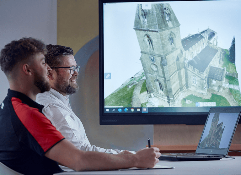
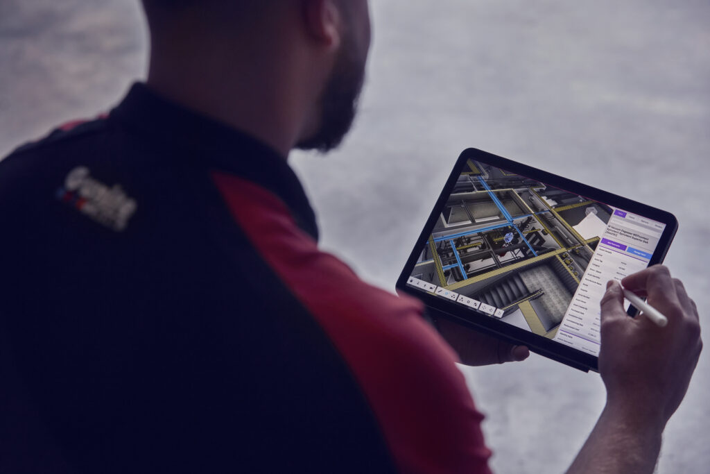
This platform allows the precise analysis and interrogation of a point cloud. Data interrogation allows users to extract data, including measurements of distances and volumes.
Our cloud technology can be accessed from any web-connected device. This, in turn, grants you access to our point clouds from almost anywhere. This has many implications regarding working with teams who do not even have to be in the same room to work on a project.
Additionally, annotation can be added and shared amongst a team. This enables better collaboration and allows true visualisation of a project site. This make use of point clouds and the information derived from them to create a clearer picture of the captured site.
How does Virtuscan deliver point cloud service?
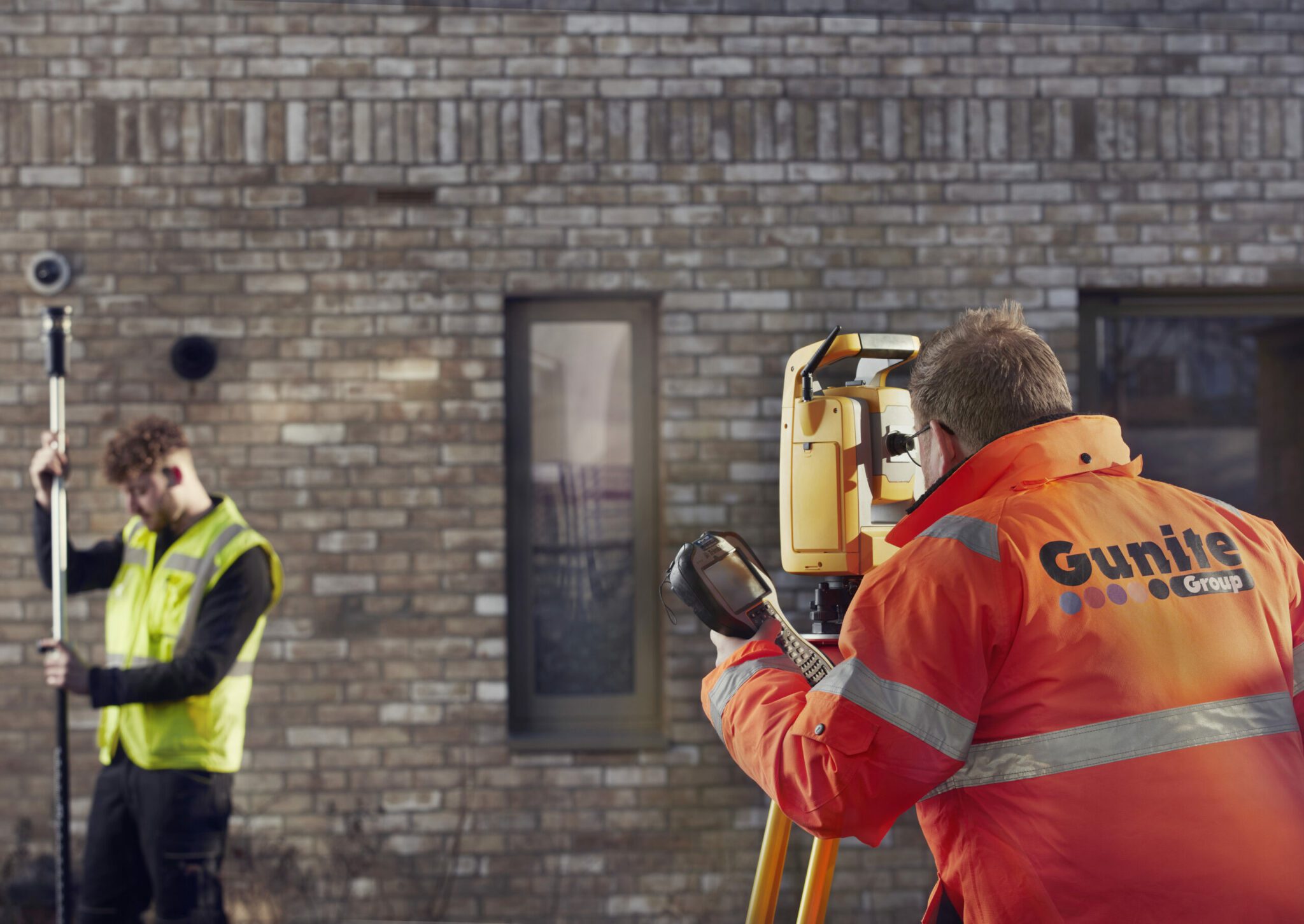
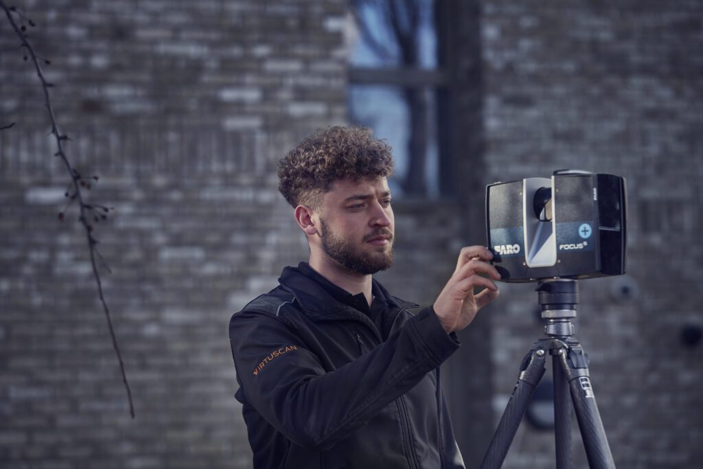
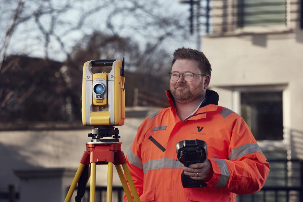
At Virtuscan, we take great pride in our ability to provide cutting-edge point cloud services. Our team of highly skilled surveyors use state-of-the-art technology, including Faro scanners and survey grade drones, to capture comprehensive data relating to various sites, structures, or properties.
By leveraging the power of this advanced technology, we not only ensure that the output is of the highest quality but also guarantee utmost safety and cost-effectiveness. Our scanning process is designed to be efficient, accurate, and secure.
Once the scanning is complete, our experts meticulously clean the obtained data to eliminate any extraneous objects that may have been captured during the scan, such as people or vehicles. This strict adherence to privacy ensures that the scanned information remains confidential while maintaining its accuracy.
The resulting scans and/or images are linked together with exceptional precision, enabling us to deliver an impeccable point cloud that can be seamlessly incorporated into your workflow.