Our Services
Drone surveys
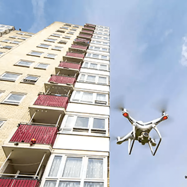
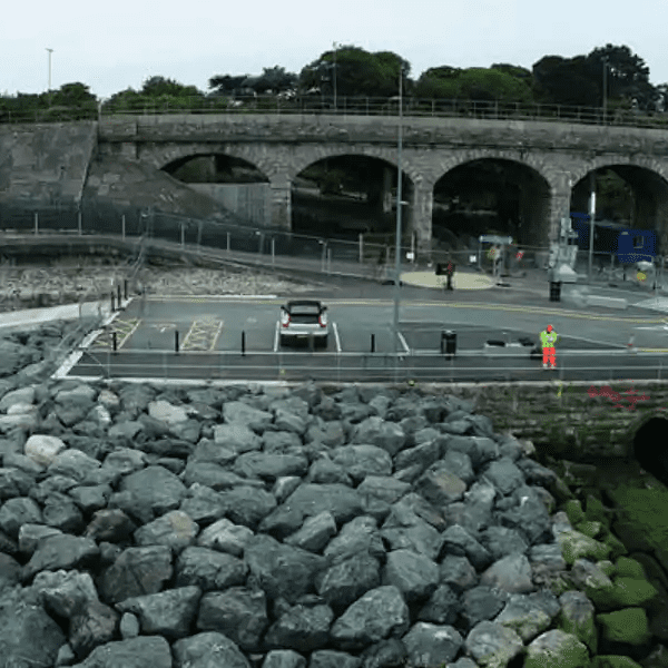
Drone surveys are unmanned aerial surveys conducted from above using drones. Using cameras and LiDAR attached to drones, these surveys capture footage of your building or site.
Traditionally, many of the areas covered by an aerial survey required the use of methods that were both risky and dangerous. From scaffolding to ladders and abseiling, none of these methods are without risk. Not only is there a risk of injury but the methods have many costs associated with them.
What are the benefits of using drone surveys?
A drone survey reduces costs and risks. It also allows aerial surveys to be conducted from a safe distance, reducing the risk of injury.
Surveys can therefore be conducted safely using the latest technology and provide a solution that is both safe and cost-effective.
Previously, many of the areas covered by the aerial survey would take days to cover. With drones these can now be conducted in a matter of hours. This reduction in time not only makes aerial surveys easier but also less costly to run. Not only are drones safer but they are also quicker.
With high quality output, the footage from the drone camera is detailed and easy to obtain. With professional-quality cameras, drones can be used to conduct surveys that are as detailed as they are useful. Virtuscan offers high-quality drone surveys that can obtain this footage in the safest way possible. Read on to discover why we might be perfect for your project.
What’s involved in a
drone survey?

See the entire project from a whole new level with Virtuscan’s drone surveys
Why use Virtuscan for your next project?
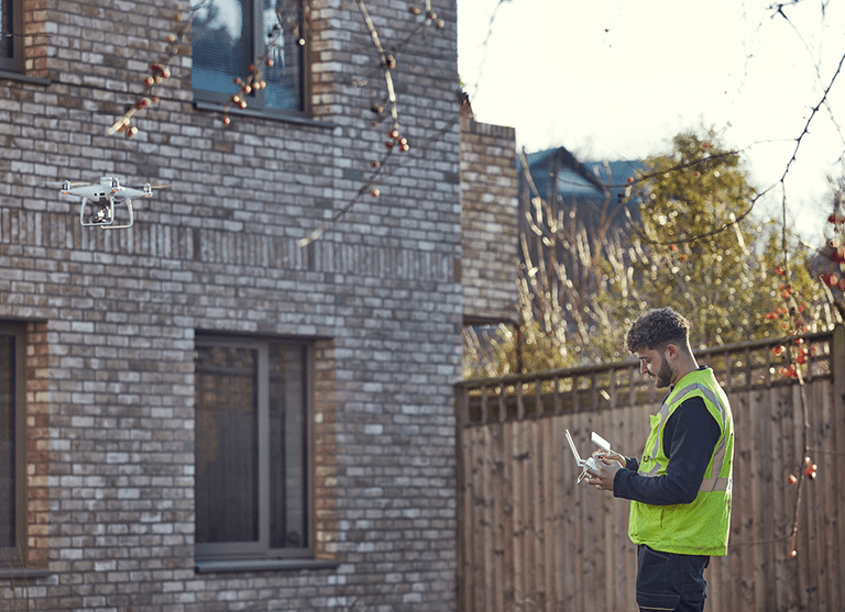
Virtuscan uses experienced pilots to conduct accurate drone surveys. Our pilots are specialists in conducting aerial surveys in areas that are hard to reach or otherwise unsafe. They make use of our sophisticated technology to ensure that piloting a drone is safe while conducting the survey with as much accuracy as possible.
All our pilots fly in accordance with CAA (Civil Aviation Authority Rules). This means our pilots fly safely as well as legally. The Civil Aviation Authority has many rules governing the use of drones. It is important to us that our pilots follow these rules in order to fly safely.
Software – Collaboration – Success
We also use state-of-the-art software to allow a project to be viewed or measured from anywhere. This can be done even on a mobile device, allowing you to access your projects from anywhere, regardless of where you are or what you’re doing.
With this software, collaboration has never been so simple or effective. With the ability to annotate point clouds or images on any project, you have many tools at your disposal. The software is designed with teamwork in mind allowing for easier collaboration between teams and individuals.
What our Surveys include
Videos and Photos
Our surveys create image outputs that are as detailed and impressive as they are informative. This ensures that all areas are well represented in the final output. Our high-quality imaging allows for the final product to be analysed in detail.
The images included with our output can be either moving or still. These different image types are perfect for analysing information about your property ensuring the condition of buildings and structures can be easily viewed. This allows for the monitoring of buildings and structures without having to take risks in terms of safety and cost.
As a result, these images offer a wealth of valuable data for your business, enabling you to proceed to the next project phase armed with comprehensive information. The applications of drone survey-generated images span diverse areas including maintenance, security, and health and safety, making them incredibly versatile and useful.
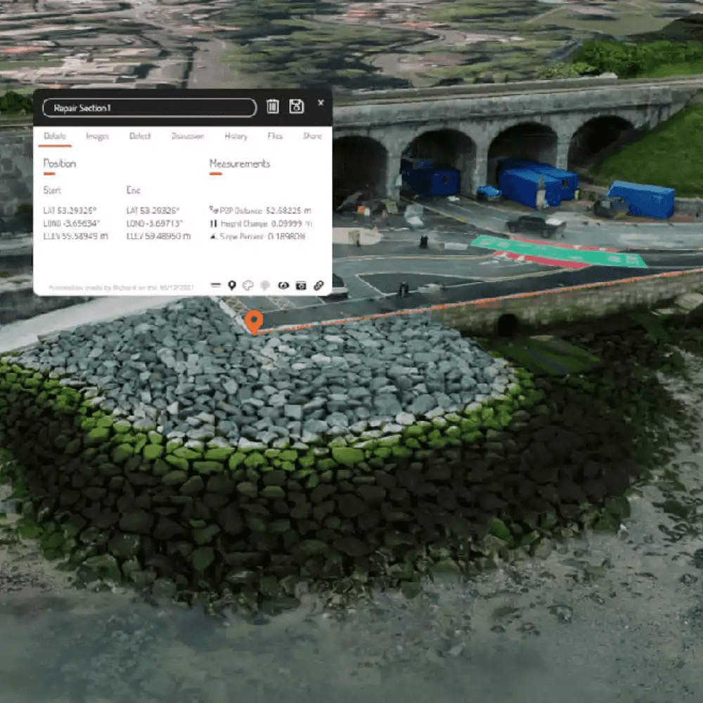
Point clouds
A set of data points used to represent a 3D object, a point cloud is an easy way to gain measurements for buildings and structures. These measurements can, in turn, be used in a variety of different ways, such as during all BIM stages. Using photogrammetry (the use of photography in surveying and mapping to ascertain measurements between objects), we obtain reliable information about your property. This information is then used to create an accurate point cloud for
your use.
Using colour, our point clouds provide accurate information for your use. They give great insight into your captured assets. They also allow visualisation from any web-connected device. This in turn allows you access to our point clouds from almost anywhere.
That is not all. We can also combine a drone-captured point cloud with a point cloud generated using a terrestrial laser scanner. This combination allows us to provide a fuller picture than one would get using only a drone-captured point cloud. In addition, the accurate images created from these two techniques allow for even more information to be gleaned from your point clouds.